
In the early days of interstellar flight, mapping systems were haphazard. Not only had subspace radio not yet been perfected but many areas already had starcharts with often-contradictory standards. Eventually it was decided to used a Mapping Index based closely on that of the Vulcan High Command. For this reason, and often due to political considerations, there are a great number of small and/or irregular areas functionally similar to sectors but not fitting precisely into the Starfleet Standard Sector Mapping Index. Sometimes it is necessary to map the area between two established sector grids in such a way as to act as buffer zones and other types of irregular stctors.

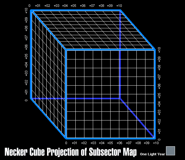 Commonly, this situation gives rise to individual idependent subsectors, cubic areas 10ly on a side. They are nominally catalogued identically to standard sectors and usually named for the dominant planet in the area, but sometimes for a prominent stellar feature such as a black hole, pulsar or quasar.

Irregular sectors are collections of subsectors the do not follow the format of a cube composed of eight subsectors. They may have as few as two subsectors or clusters of dozens, all connected by at least one face. The largest of these are generally comprised of a single stellar nation which does not have formal relations with the United Federation and thus is not mapped aside from long-range sensor scans. An example of such a gigantic super-sector would be the Orion Neutrality Area, a sphere 34ly in diametre comprising 1,624,890ly³, or the equivalent of over two hundred standard sectors!
|


